
Better Boating With AI
Published on April 7, 2024


The year 2024 is shaping up to be the year that artificial intelligence (AI) explodes across all types of businesses and industries. The concept has been around for a long time, but with the introduction of products like self-driving cars, ChatGPT and AI Art, it is shifting from platforms for scientists and engineers to something anyone can use. The recreational boating industry, traditionally a tentative player with new technology, is stepping aboard with some new AI products.
Navigate Like a Local
Boaters today may not use paper, but they still plot their routes on charts—they just do it digitally. It’s a simple process of putting in the coordinates of the boat’s current location and end destination and following the route. But what happens when a navigational aid goes missing, there’s an extreme low tide, shoaling happens from a recent storm or an abandoned boat appears? Anyone who boats regularly to new areas knows that what the chart shows and what’s out there can differ and cause a bad day on the water.
Peter Williams and Owen Davies, founders of Ditch Navigation, have set out to help boaters navigate like locals, no matter where they are cruising. Both avid boaters, the men have had their share of boating mishaps and wanted to use their combined technological experience to help keep others from going astray or hitting bottom.
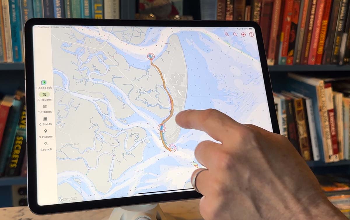
Their patent-pending navigational app takes full advantage of AI and AIS data while retaining the traditional use of NOAA charts and U.S. Army Corps of Engineers depth information. AIS or Automatic Identification System data is collected through the U.S. Coast Guard through on-board navigation safety devices. The system continuously tracks vessel movements and the characteristics of each boat, like length, beam, type and draft. By using this data in the Ditch app, a boater can enter the details of his boat and see the best routes for boats of similar dimensions. “We don’t crowdsource data ourselves. We go to publicly available AIS data and use that with NOAA chart data to build the application,” Davies said. It’s the use of AIS and AI that helps to differentiate this app from others on the market.
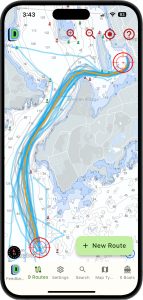
The concept is the same as traditional chart plotting. Enter a start and end point, but the Ditch app then offers an array of routes with one identified as the SmartPath™ or the most widely used based on the current boating information as well as the vessel’s dimensions. The plotting can also be used to find the best boating, starting from a single coordinate. For those in unfamiliar territory, it can help them chart a route for the best day on the water.
The Ditch that is available today, for free through the website or for a small fee for a smartphone or tablet app, will be evolving even before the year’s end. Davies said the information is focused on large data sources, but they plan to bring in local data and information on historic weather patterns, tides and currents.
Williams said he envisions enabling boaters to find directions directly into a marina’s slip, giving customers confidence in how to get to a facility and saving marina staff time in discussing the best way to get there. He explained that it’s not uncommon for publications like the Waterway Guide to suggest calling a marina for the best directions, understanding conditions can change more rapidly than a guide is published. Ditch will save boaters and marina personnel the time of a phone call.
Williams and Davies are continuing to refine the algorithms, and they predict more exciting changes will be coming in the next year. “The end of this year, it (the app) will be a lot different than it is today. We’re moving it more in the direction of the AI that people would expect,” he said. With that innovation will come increased safety and better peace of mind for boaters cruising away from homeport.
Safety at Sea
Getting from point A to point B safely is also at the forefront of new AI technology being introduced by Avikus. Founded in 2021 by shipbuilder HD Hyundai, Avikus specializes in developing autonomous navigation solutions. The company’s newest product is NeuBoat Navi. “I hesitate to use the term autonomous,” said Paul Petani, managing director for Avikus US. “We are not creating self-driving boats, but more a driver assist feature. Boats still need captains,” he said.
Boats with autopilot are nothing new. In simple terms, once technology came online that allowed for a captain to enter a route into computer that “talked” to a vessel’s steering gear, hands could be taken off the wheel, allowing captains a chance to rebait or take a necessary break. The downside of traditional autopilot systems is that they kept the boat strictly to the pre-programmed route, never considering other boats or obstacles that may be along that path.
The concept behind NeuBoat Navi is that the system allows for point-to-point route planning and then monitors the waters surrounding the route for obstacles to help ward off collisions. It relies on AI based obstacle detection and sensor fusion for situational recognition through onboard radar, Lidar and cameras. Boaters are alerted to an obstacle and then rerouted to avoid collision. It’s similar in concept to GPS systems in cars that alert drivers of accidents and offer routes around them.
Avikus has been working with Twin Vee to perfect how the technology works with different types of boats. Twin Vee offers catamarans under the Twin Vee brand, electric-powered boats under the Forza line and center console outboards through Aquasport. The partnership with Twin Vee allows Avikus to go from concept to real-world in looking at camera design and installation, sensor installation and other practicalities of installation and use. With Twin Vee located in Florida, testing can occur year-round to examine the system’s liability and quality under differing conditions.
The NeuBoat Navi system will also encompass the features of NeuBoat Dock that Avikus launched last year with Raymarine. This tool helps boaters dock their boats with a surround view system that offers 360-degree situational awareness. Six cameras give full visibility of every angle, as well as distances between the boat and other objects. It removes the need for having lookouts shout directions to the captain and decreases the chance of hitting piles and damaging the boat. “We launched in Europe, and we have about five builders now installing NeuDock as part of their manufacturing process,” Petani said. “We have a visionary CEO who embraces new technology. We see the industry starting to change and be willing to adopt technologies that other industries have already been using.”
That visionary is looking ahead to developing additional features that consumers want, like man overboard detection or a return to homeport feature. “As we develop our software, these ideas and others are in the realm of possibilities,” Petani said. “We want to be the first to market with a product that has tangible benefits and show that builders are willing to embrace new technology to differentiate themselves from competitors.”
The goal is to bring NeuBoat Navi to market within the next 12 months. It will be available both direct from the manufacturer and as a retrofit to existing boats.

| Categories | |
| Tags |